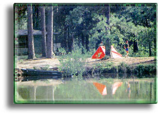
 Referred to collectively as the National
Forests in Texas, the Angelina, Sabine, Davy Crockett,
and Sam Houston National Forests are in the heavily
forested "Piney
Woods" of East Texas. They
are comprised of 634,912 acres of federally owned land
scattered throughout 12 counties. The National Forests
are administered by the U.S. Forest Service under the
multiple use principle with each natural resource -
timber, water, forage, wildlife and recreation - managed under a coordinated, balanced
plan. Referred to collectively as the National
Forests in Texas, the Angelina, Sabine, Davy Crockett,
and Sam Houston National Forests are in the heavily
forested "Piney
Woods" of East Texas. They
are comprised of 634,912 acres of federally owned land
scattered throughout 12 counties. The National Forests
are administered by the U.S. Forest Service under the
multiple use principle with each natural resource -
timber, water, forage, wildlife and recreation - managed under a coordinated, balanced
plan.
Primitive camping is allowed in all
areas except where posted. No electric, water or sewer
hookups are provided at any camping area. Hunting and
fishing in National Forests is regulated by the Texas
Parks and Wildlife Department. Developed recreation areas
have varying facilities as shown in the chart. Fee areas
require self-deposit of fees for overnight camping or day
use of developed swimming beaches. Some areas have been
set aside as "wilderness areas" to provide
totally primitive camping experiences. No wheeled
vehicles of any kind are permitted in the wilderness
areas.
ANGELINA
NATIONAL FOREST -
Smallest with 154,307 acres in
Angelina, Jasper, Nacogdoches and San Augustine Counties,
with these recreational areas:
- Bouton Lake - Southeast
of Zavalla: 7 miles east on Texas 63, 7 miles
south on Forest Service Road (FSR) 303.
- Boykin Springs -
Southeast of Zavalla: 11 miles east on Texas 63,
3 miles south on FSR 313.
- Caney Creek - On Lake
Sam Rayburn about 14 miles southeast of Zavalla
via Texas 63, F.M. 2743.
- Harvey Creek - On Lake
Sam Rayburn about 9 miles east and south of
Broaddus via F.M. 83, F.M. 2390.
- Sandy Creek - On Lake
Sam Rayburn about 21 miles southeast of Zavalla
via Texas 63, FSR 333.
- Townsend - F.M. 103
east of Lufkin 28 mi.; right on F.M. 1277 3 mi.;
right on F.M. 2923 2 mi.
DAVY
CROCKETT NATIONAL FOREST -
161,500 acres in Houston and
Trinity Counties, containing these recreational areas:
- Big Slough Canoe Trail and
Wilderness Area - On Neches River near Neches
Bluff From Ratcliff, F.M. 227 north 2 miles, east
5 miles on FSR 547, north on FSR 511.
- 4-C's Hiking Trail - A
19-mile trail between Ratcliff Lake and the
Neches Bluff overlook South of Texas 21.
- Kickapoo - About 1.5
miles southeast of Groveton on U.S. 287.
- Neches Bluff - On
Neches River about 7 miles southwest of Alto via
Texas 21, FSR 511.
- Ratcliff Lake - On
Texas 7, 20 miles cast of Crockett.
SABINE NATIONAL
FOREST -
Includes 157,951 acres in Jasper,
Sabine, San Augustine, Newton and Shelby Counties with
these recreational areas:
- Indian Mounds Recreation
Site and Wilderness Area - On Toledo, Bend
Reservoir, east of Hemphill via F.M. 83 about 5
miles, and 7 miles southeast and south on FSRs
115 and 115A.
- Lakeview - On Toledo
Bend Reservoir, primitive camping area, 16 miles
southeast of Hemphill via Texas 87 and local
road.
- Ragtown - On Toledo
Bend Reservoir about 15 miles southeast of
Shelbyville via Texas 87, east on F.M. 139 and
FSR 132.
- Red Hills Lake - About
3 miles north of Milam via Texas 87.
- Willow Oak - On Toledo
Bend Reservoir about 14 miles southeast of
Hemphill via Texas 87, FSR 117.
SAM HOUSTON
NATIONAL FOREST -
161,154 acres in Montgomery, San
Jacinto and Walker Counties with these recreational
areas:
- Double Lake - About 4
miles south of Coldspring via Texas 150, F.M.
2025.
- Kelley Pond - off-road
vehicle area. From New Waverly, F.M. 1375 west 11
miles; south one mile on FSR 204; west one mile
on FSR 271.
- Lone Star Hiking Trail
- A 27-mile segment of 140-mile forest hiking
route is designated National Recreation Trail.
Begins near Montague Church on F.M. 1725 approx.
6.7 miles northwest of Texas 105 (near
Cleveland). Obtain map from forest ranger.
- Stubblefield Lake - On
West Fork of San Jacinto River hour 12 miles
north and west of New Waverly. From I-45: F.M.
1375 northwest 7.8 miles, FSR 215 southwest 3.3
miles.
 Check
out our Guide to Texas Outside for more information on our State
parks and forests. Check
out our Guide to Texas Outside for more information on our State
parks and forests.
|


